Home > Digitized Walters Manuscripts
This document is a tranformation of a TEI P5 XML manuscript description incorporating images. If you have trouble reading special or non-Latin characters on this page, please make sure you have appropriate Unicode fonts installed and an up-to-date web browser.
Walters Ms. W.660, Maritime atlas
Browse images (Browse images in a new window) | TEI in XML format
W.660
Maritime atlas
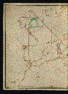
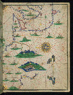
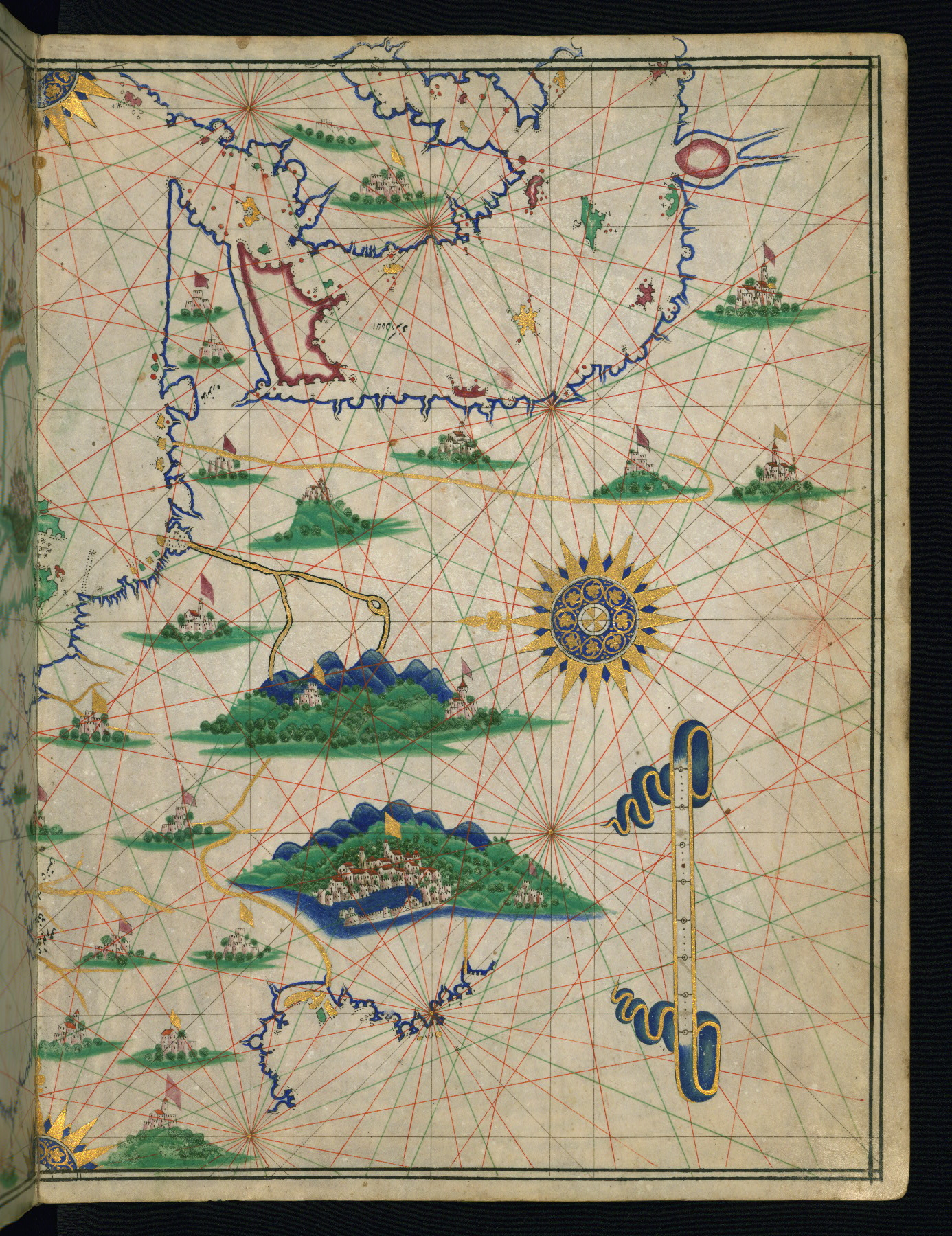
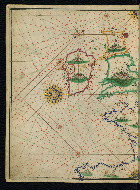
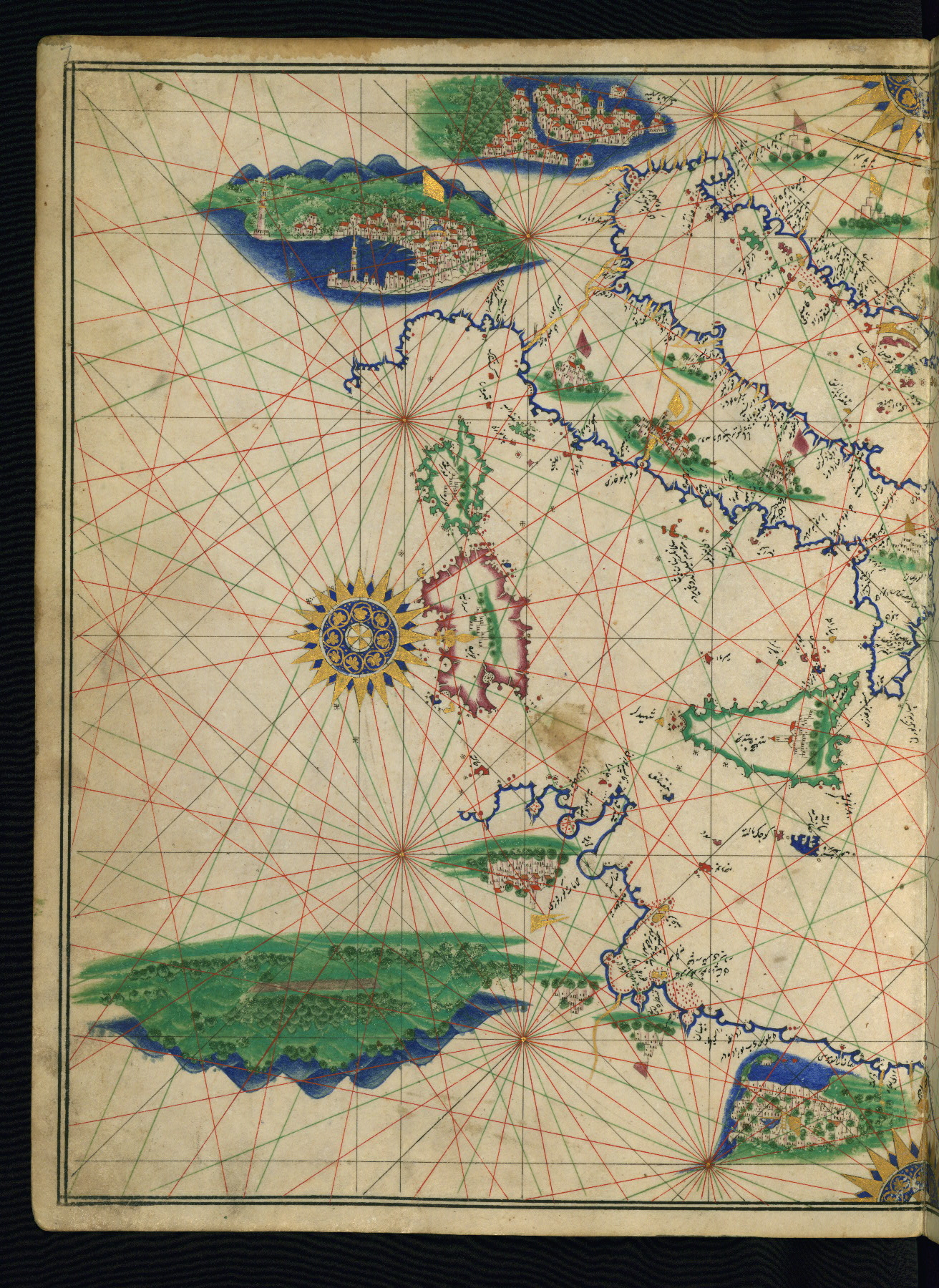
This is an illuminated and illustrated maritime atlas, referred to as the Walters Deniz atlası. It is an early Ottoman atlas, perhaps dating to the tenth century AH / sixteenth CE. The work contains eight double-page charts executed on parchment. Four of the maps show the Mediterranean, Aegean, and Black seas. There is also a world map and a chart of the Indian Ocean. The various geographical names are written in black nastaʿlīq script. A distinguishing feature of this atlas is the detailed approach to representing such features as city vignettes.
10th century AH / 16th CE
Turkey
Book
Scientific
The primary language in this manuscript is Turkish, Ottoman (1500-1928).
Foliation: ii+9
Flyleaves of Italian tre lune paper with a strip of marbled paper as a guard (3.0 cm wide)
22.5 cm wide by 30.0 cm high
- Title: Deniz atlası
- Text note: No text
- Hand note: Written in black nastaʿlīq script for geographical names
- Decoration note: Charts drawn in various colors including black, red, gold, green, blue, deep rose, light green, and yellow
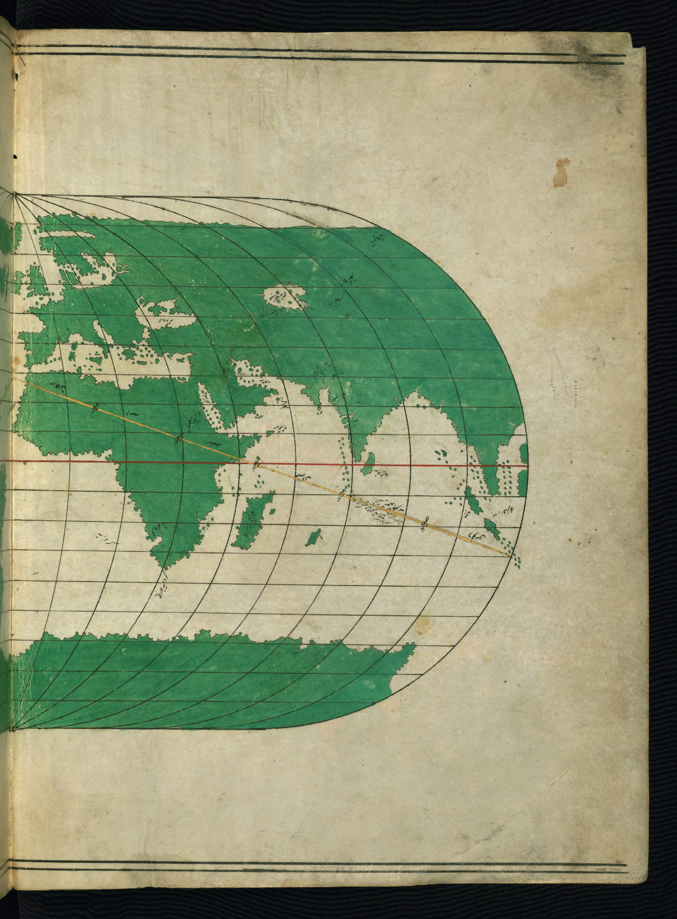
fol. 1b:
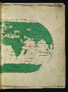
- Title: Right half of a world map showing Africa and the Far East
- Form: Map
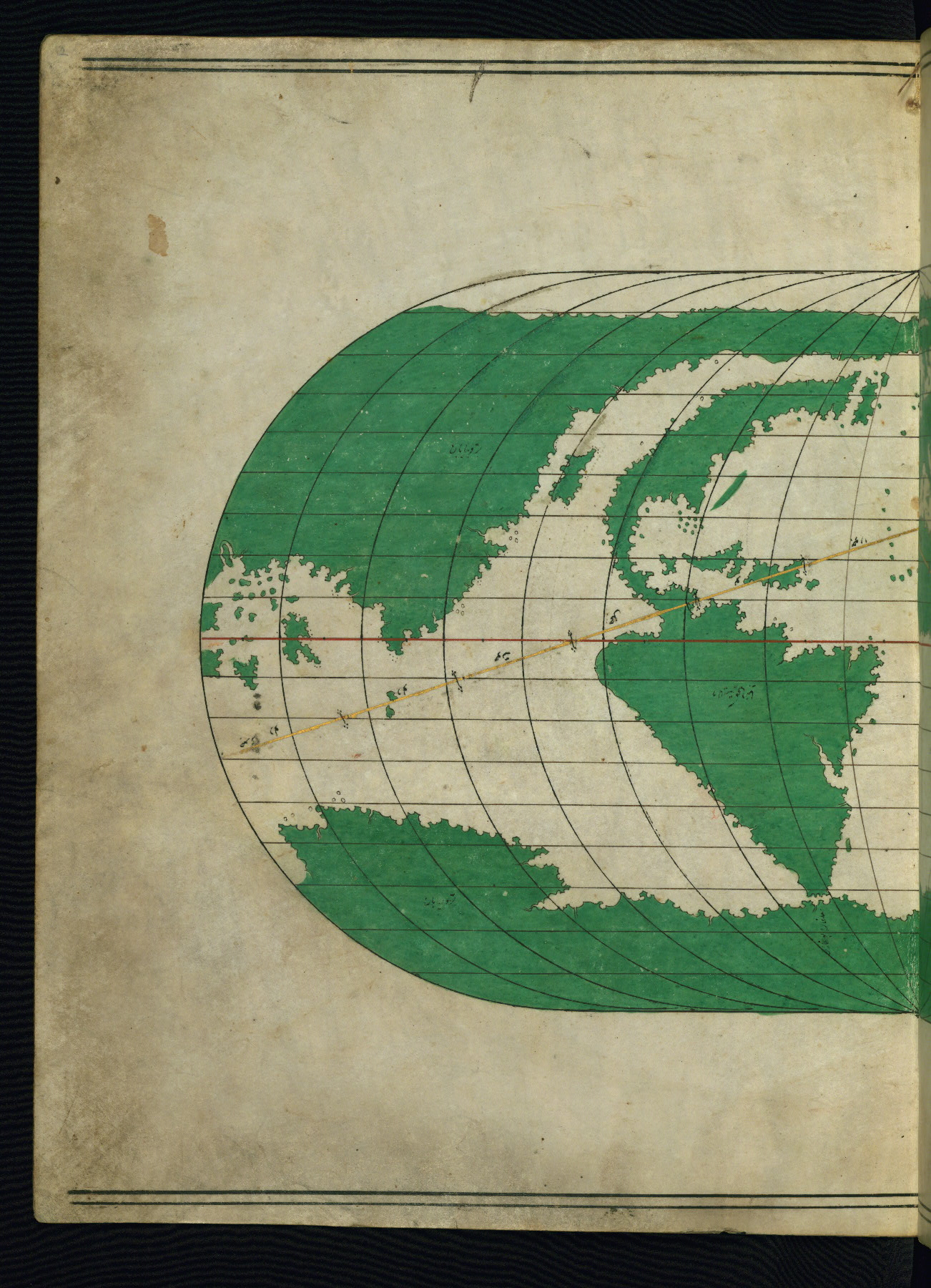
fol. 2a:
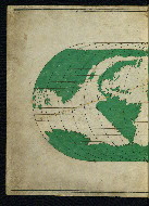
- Title: Left half of a world map showing the Americas
- Form: Map
fol. 2b:
- Title: Indian Ocean and South Asia
- Form: Map
fol. 3a:

- Title: East Africa and the Arabian Peninsula
- Form: Map

fol. 3b:
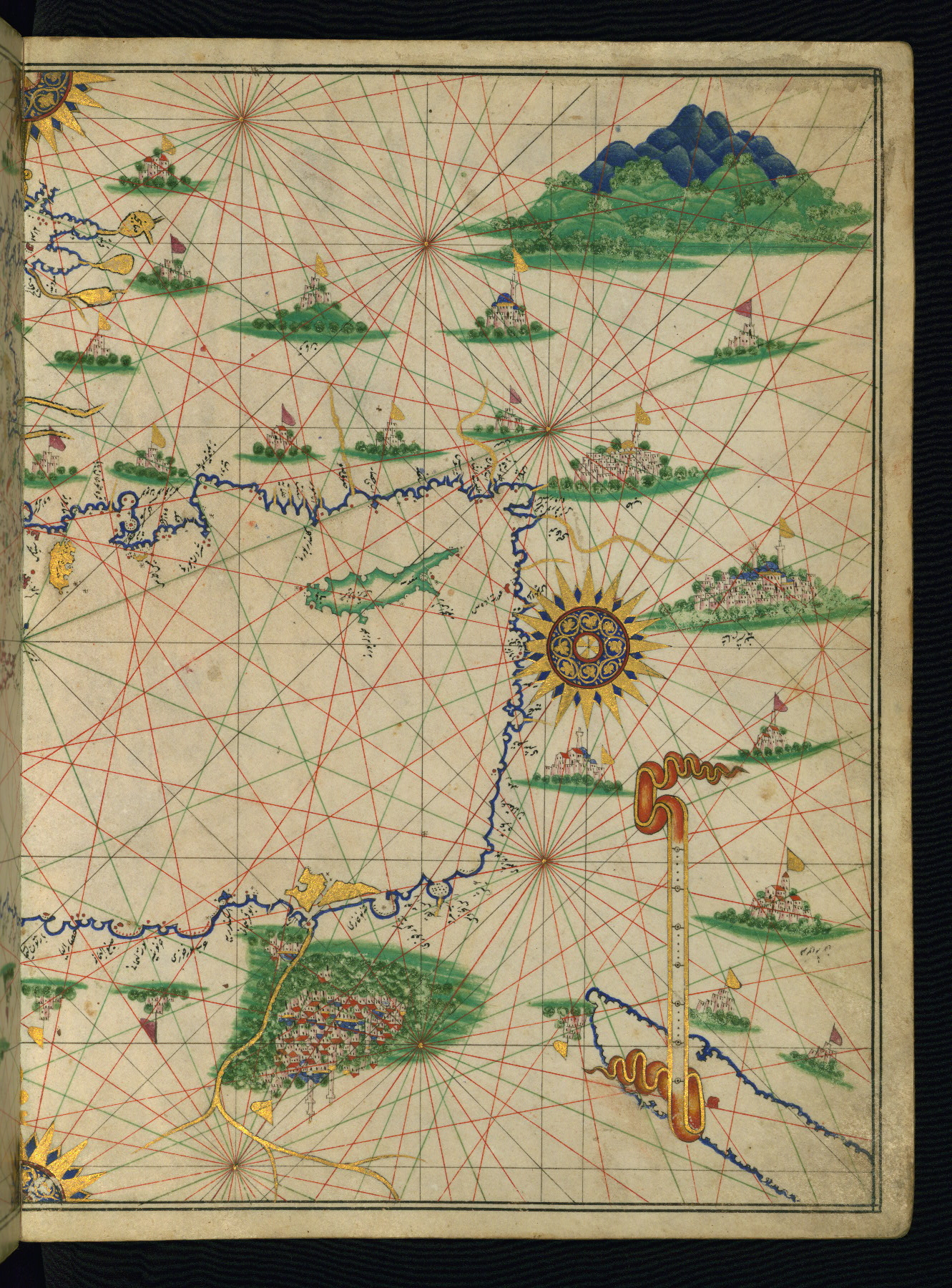
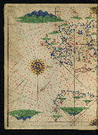
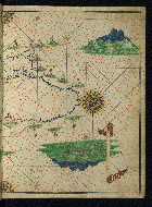
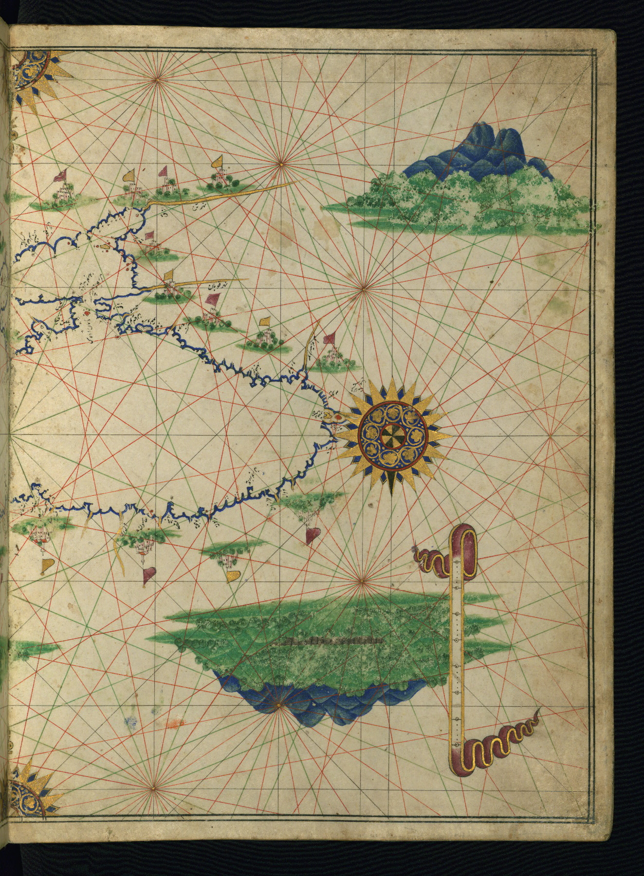
- Title: Eastern Mediterranean and the Caspian Sea
- Form: Map
fol. 4a:
- Title: Western Mediterranean and Western Europe
- Form: Map

fol. 4b:
- Title: France and northwestern Europe
- Form: Map
fol. 5a:
- Title: Northwestern Europe and the British Isles
- Form: Map

fol. 5b:
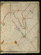
- Title: Western Mediterranean Sea with the coastlines of France and North Africa
- Form: Map
fol. 6a:
- Title: Iberian Peninsula
- Form: Map
fol. 6b:
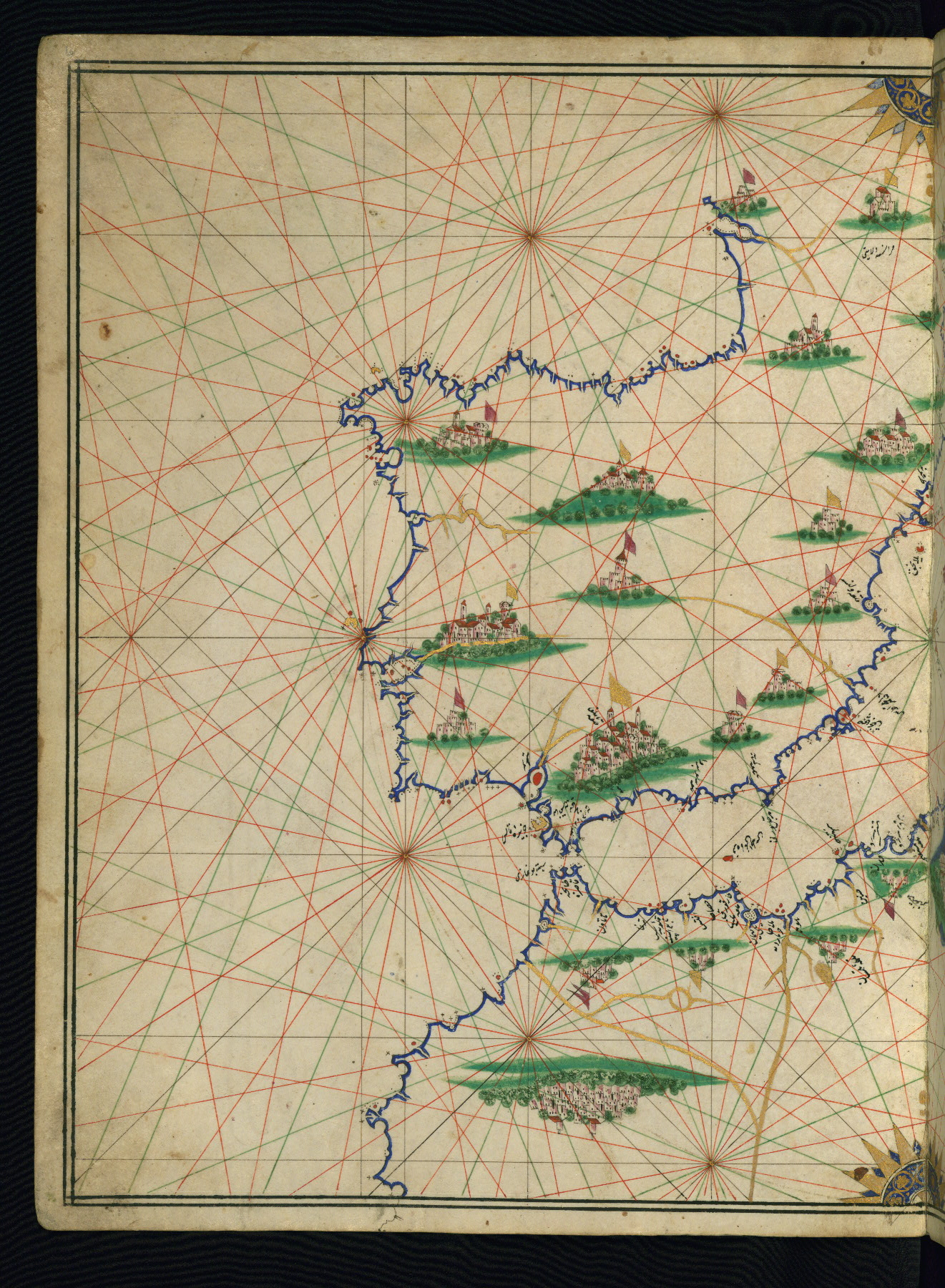
- Title: Central Mediterranean and the coastline of Greece
- Form: Map

fol. 7a:
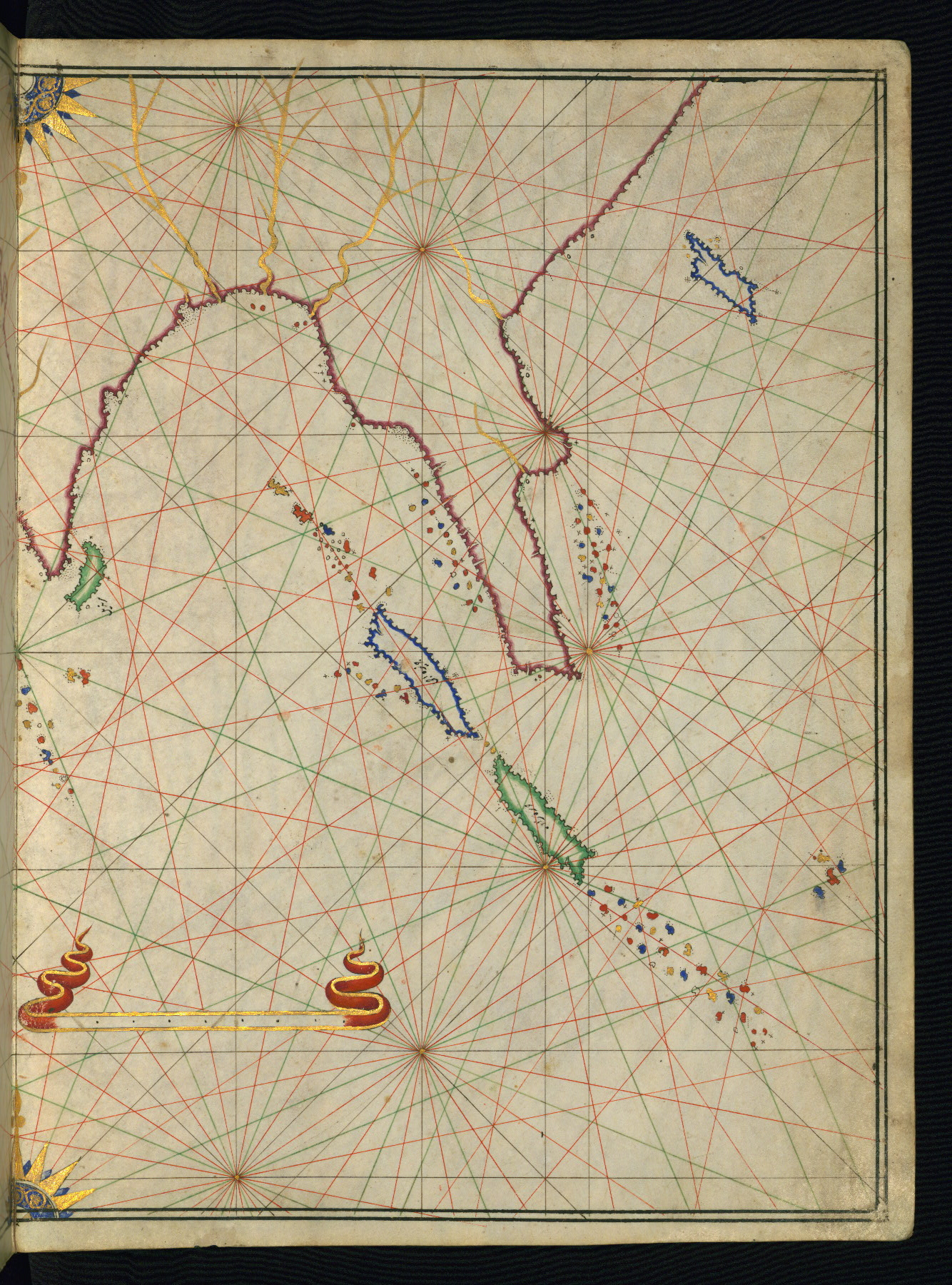
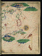
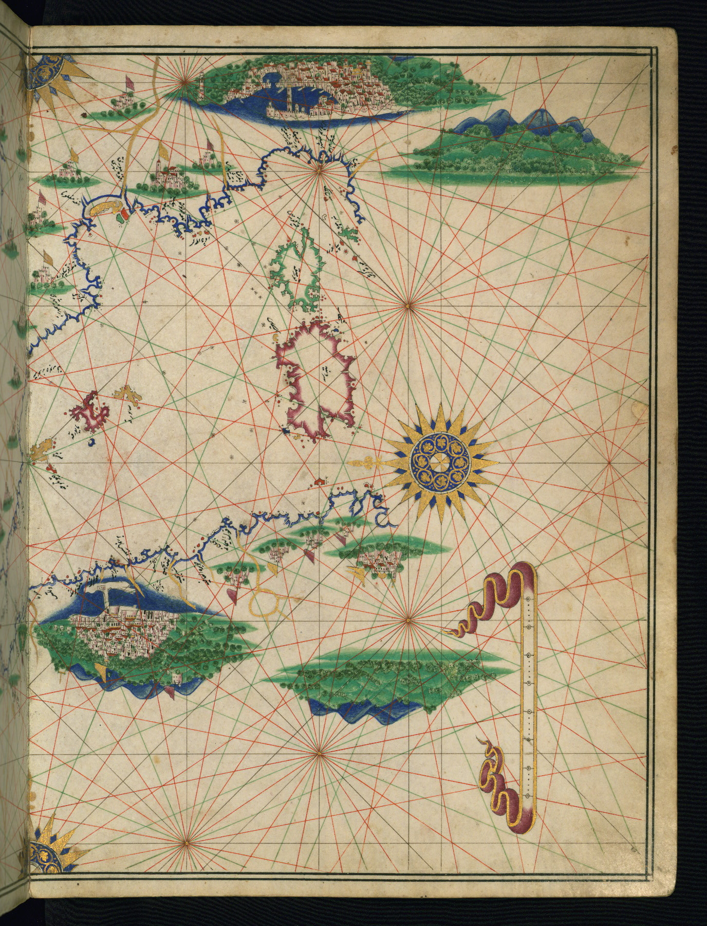
- Title: Central Mediterranean with Italy and the Adriatic Sea
- Form: Map
fol. 7b:
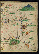
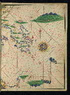
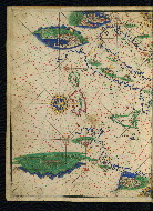
- Title: Eastern Mediterranean and the Aegean Sea
- Form: Map
fol. 8a:
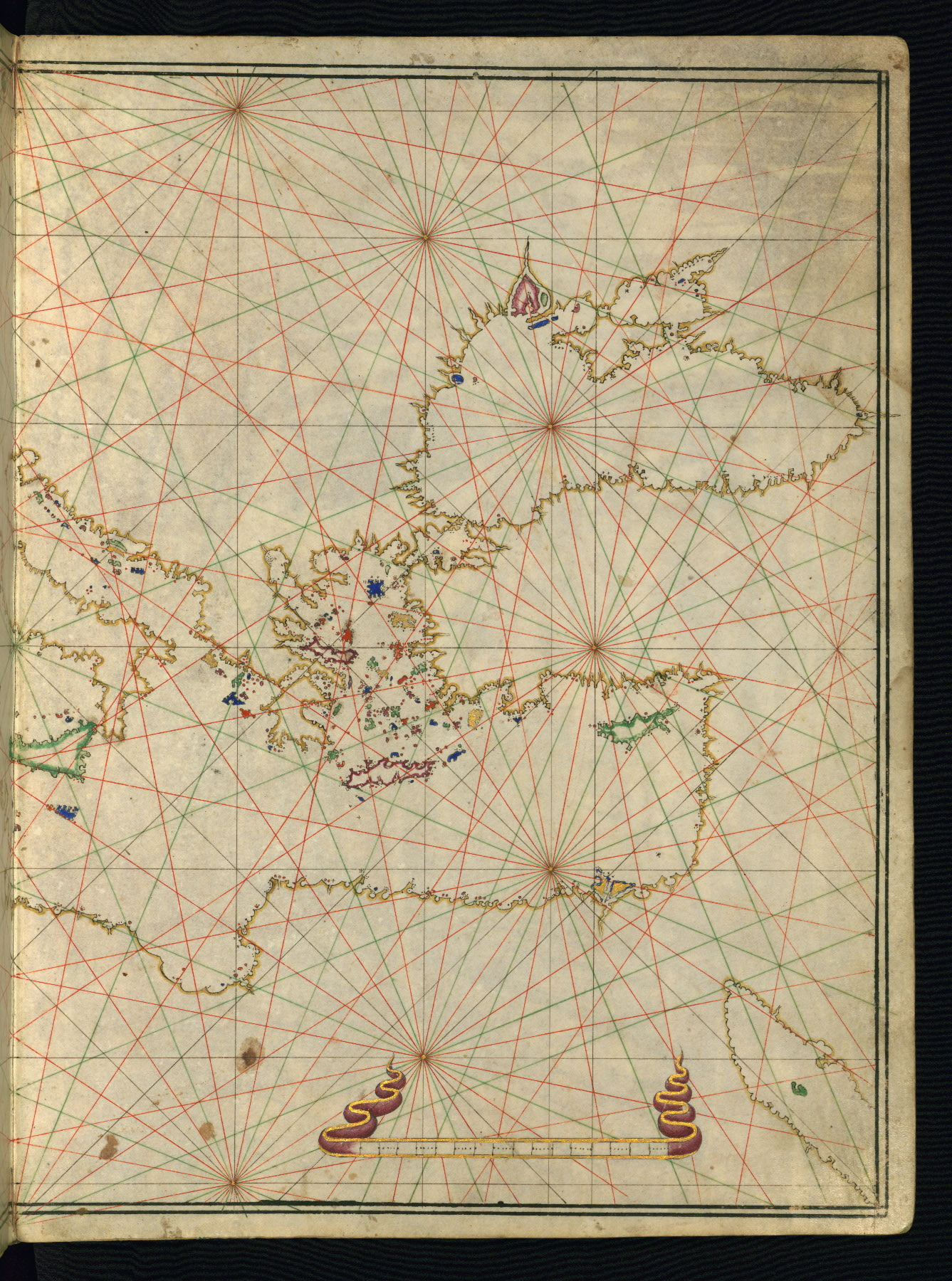
- Title: Southern Greece and the Aegean Sea
- Form: Map

fol. 8b:
- Title: Black Sea and the Marmara
- Form: Map
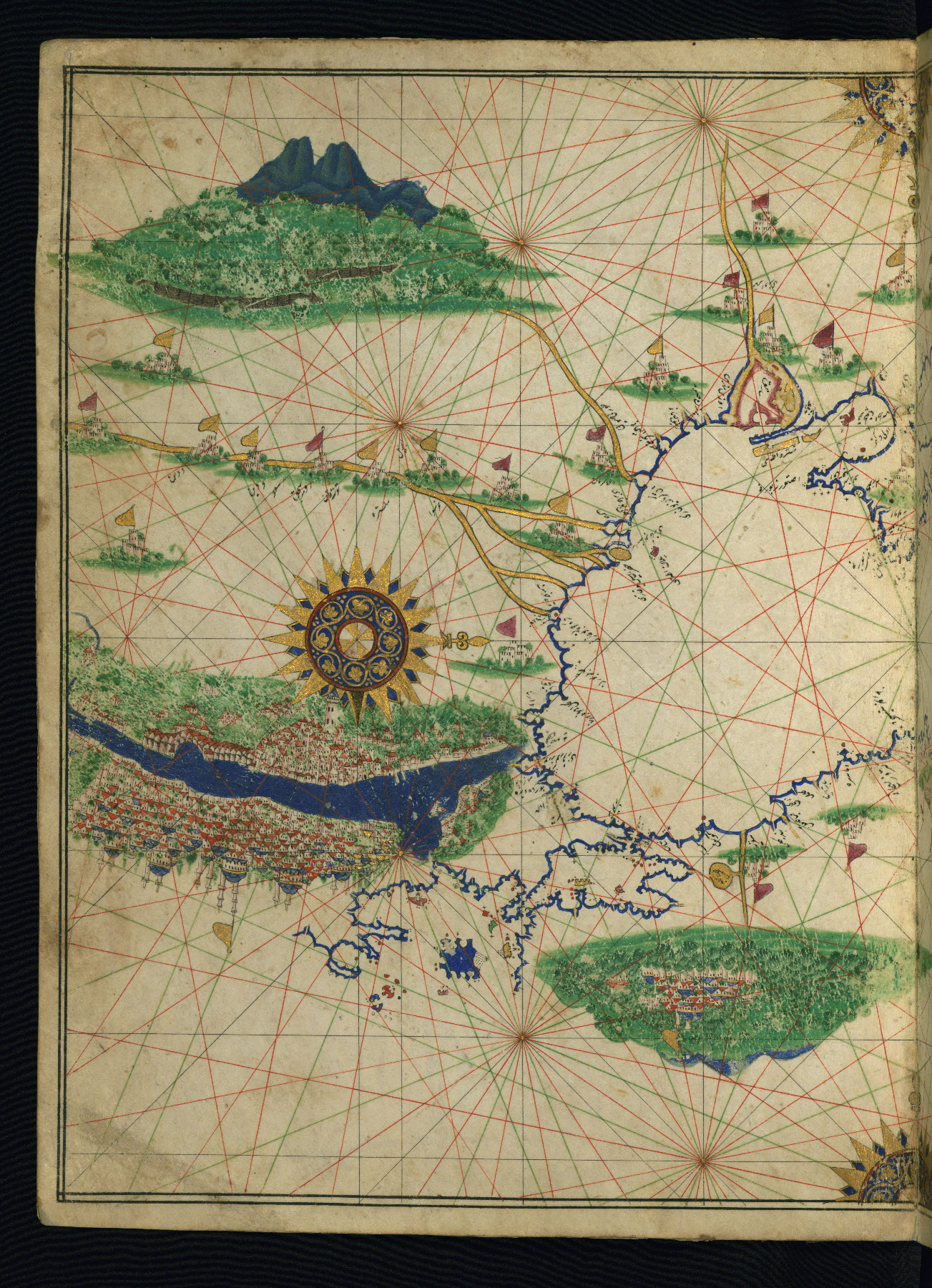
fol. 9a:
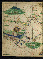
- Title: Western part of the Black Sea and the city of Istanbul
- Form: Map
Old shelf mark on the tail edge reading 2987
Walters Art Museum, 1931, by Henry Walters bequest
The World Encompassed; An Exhibition of the History of Maps Held at the Baltimore Museum of Art October 7 to November 23, 1952. Organized by the Peabody Institute Library, the Walters Art Gallery, [and] the John Work Garrett Library of the Johns Hopkins University in cooperation with the Baltimore Museum of Art. (Baltimore: Trustees of the Walters Art Gallery, 1952), no. 105.
Goodrich, Th. D. "The Earliest Ottoman Maritime Atlas: The Walters Deniz Atlasi." Archivum Ottomanicum 11 (1986 [1988]): 25-50.
Harley, J. B., and David Woodward. Cartography in the Traditional Islamic and South Asian Societies. (Chicago: University of Chicago Press, 1992), 282.
Soucek, Svat. "The 'Ali Macar Reis Atlas' and the Deniz Kitabi: Their Place in the Genre of Portolan Charts and Atlases." Imago Mundi: The International Journal for the History of Cartography 25, no. 1 (1971): 17-27.
Loupis, Dimitris. "Ottoman Nautical Charting and Miniature Painting: Technology and Aesthetics." In M. Uğur Derman 65th Birthday Festschrift / 65 Yaş Armağanı, ed. İrvin Cemil Schick (İstanbul: Sabancı Üniversitesi, 2000), 369-397, esp. 391.
Principal cataloger: Gacek, Adam
Catalogers: Landau, Amy; Smith, Sita
Editor: Bockrath, Diane
Conservators: Jewell, Stephanie; Quandt, Abigail
Contributors: Barrera, Christina; Emery, Doug; Herbert, Lynley; Noel, William; Simpson, Shreve; Tabritha, Ariel; Toth, Michael B.; Valle, Chiara
The Walters Art Museum
Licensed for use under Creative Commons Attribution-NonCommercial-ShareAlike 3.0 Unported Access Rights, http://creativecommons.org/licenses/by-nc-sa/3.0/legalcode. It is requested that copies of any published articles based on the information in this data set be sent to the curator of manuscripts, The Walters Art Museum, 600 North Charles Street, Baltimore MD 21201.